United States Natural Landscapes
The first settlers who settled both on the Atlantic coast and on the Pacific coast of the United States and the first travelers who ventured to travel the inland regions found an aspect of the landscape that was profoundly different from the present one, especially as regards the physiognomy of the vegetation. It is difficult to reconstruct this physiognomy in its details; but an idea of the gigantic transformations that took place in four centuries can be had when we say that at the beginning of the century. XVI the wood, in its different types, certainly covered more than half of the territory of the present United States. It was clearly divided into two areas: the eastern one, extended as a continuous zone on the Atlantic and Gulf coasts, from the borders with Canada to the Mississippi, on the whole Appalachian region, the entire left side of the basin of the great river and, to the South., also over a good part of the lower trunk of Arkansas and the Red River; the western one, which covered all the chains, both of the Rocky ones, and of the series closest to the Pacific. Between the two areas, the intervening zone of the Prairies, very poor in trees due to the already noted climate conditions. Today the forest has disappeared for three quarters. The eastern area has suffered the most serious damage, for having been the subject of ruthless destruction that lasted two and a half centuries and imposed by the need to procure building materials and firewood, and to conquer space for crops; what remains represents much less than a tenth of the original surface, despite the reforestation attempts of the last decades. In the western area the forest has been damaged by
But we must not forget that the central region of the Prairies underwent no less profound transformation, occupied, before the advent of the Europeans, almost exclusively by spontaneous vegetation and now reduced to cultivation. Here, too, the original appearance of the steppe is preserved only in the semi-arid Great Plains, at the foot of the Rocky Mountains, and in the desert regions of SW. Unchanged, except in the short areas acquired for agriculture with the aid of irrigation, the intermontane basins have also remained, especially where the soil is made up of hard lava shells or is impregnated with salt.
But on the whole, the United States certainly represents the largest surface area of the earth in which man has, in the course of the modern era alone, made the greatest transformations of the natural landscape.
The natural regions. – On the basis of the morphological and climatic characteristics we have described, we can distinguish in the United States some large natural regions, each of which, having a usually considerably greater extension than the regions commonly distinguished in Western Europe, can be time to subdivide into several sub-regions.
- The broader Appalachian region includes: a) New England; b) the real Appalachian Mountains; c) the Great Valley to which the Hudson-Champlain groove can be reconnected to N.; d) Piedmont; e) the western highlands (Appalachian Plateaus); f) the Adirondack Mountains.
- The coastal plains region, which stretches from New England along the Atlantic and the Gulf of Mexico to the Rio Grande del Norte, includes: a) the “Ancient South”; b) Florida; c) the eastern plains of the Gulf; d) the lower Mississippi valley; e) the western plains of the Gulf.
The region of the central plains, commonly known as the Middle West, embraces: a) the prairies proper; b) the hilly hills facing the Great Lakes; c) the region of the Ouachita and Ozark mountains; d) the highlands of Kentucky and Tennessee.
- On the meridian of 95 ° and 100 ° W runs approximately the morphological limit between the region of the lowlands and that of the grassy highlands of W, and this limit has, as we have already seen, also a climatic significance. To the west of this limit remains the region of the great plains (Great Plains) which rises towards the Rocky Mountains.
- The Rocky Mountain region includes: a) a northern section; b) a southern section, separated by the large breach indicated by the valleys of the North Platte and the Green River.
The region of the great intermontane basins includes: a) the Columbia plateau; b) the Great Basin proper; c) the Colorado plateaus; d) the desert highlands of Arizona and Sonora with the arid lowlands overlooking the Gulf of California.
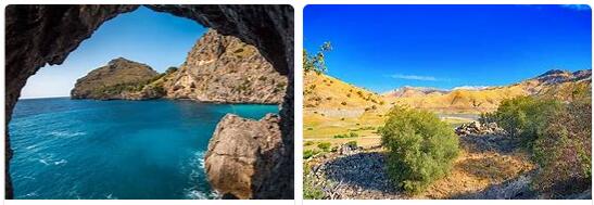
Finally, the Pacific region includes: a) the north-west belt (at N. del Capo Mendocino); b) California.
The subdivision scheme shown here is made clear by the map inserted above. A more summary division, but also widely used in official statistics, in which states are grouped into groups, distinguishes: a) New England; b) the Middle Atlantic; c) the South Atlantic; d) the NE Center; e) the NO Center; f) the SE Center;.) the SO Center; h) the Mountain; i) the Pacific. For the area of these subdivisions see the table on p. 535.